I had to do a bit of eye-balling, but eventually I found it. Supposedly this is imagery showing Area 51 near Rachel, Nevada on Google Maps. Other resources on the web seem to corroborate that (click for a lot of info from a guy who tried this well before I did).
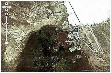
Now, why in the world would they only have low-res imagery of this area??? Escapes me... At least they've blocked out the rooftops of the White House and other critical buildings.
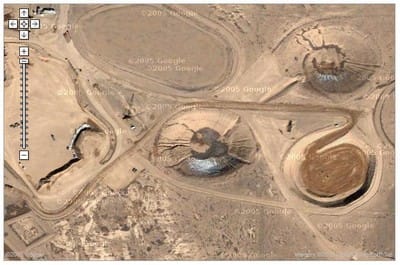
By the way, some people have been wondering what the "lumps" in the ground are to the southwest of Area 51. As it turns out, I don't think that's part of Area 51 at all. My memory tells me that's Areas 1-30 at the Nevada Test Site, if I am not mistaken. And those aren't actually lumps either - they're craters from the underground detonations that have been done at the test site over the years:
Google Maps is just too much fun. Here's the USS John C. Stennis, which is an aircraft carrier that two friends serve on - and it's also the one I spent a week on last year, underway from from Hawaii to San Diego.
I went chasing all this stuff down after FilmDivision uploaded a similar image to Flickr.

Member discussion: